After we were dropped off at the foot bridge, we crossed over to the ‘other side’. It is really neat. You are going into the past and it starts right there. On our way back across the bridge we saw some river rafter’s and a kayaker or canoeist going down that river.
On the other side of the river was a ‘van’ stop with a schedule of picks and locations. We decided since we had about 20 or so minutes that we would walk up to McCarthy as it was only about 1/4 of a mile up the road. Interesting walk.
Rails left rusting by the road. How long? Who knows?
Sense of humor just outside the bus stop area near McCarthy.
On the way up to Kennecott mine, 4.5 miles from McCarthy, the road is quite rough as it has lots and lots and lots of pot holes (you could lose a VW) and few automobiles are allowed in the ‘compound’. The road is a 1 lane move over if you can when you meet another car. I couldn’t get a good photo because of the bouncing. A fast, bouncing, drive by of an old Valdez fire truck parked near McCarthy on the road up to Kennecott.
Upon arriving we picked up a brochure about where to find what and looked around. Isn’t it magnificent.
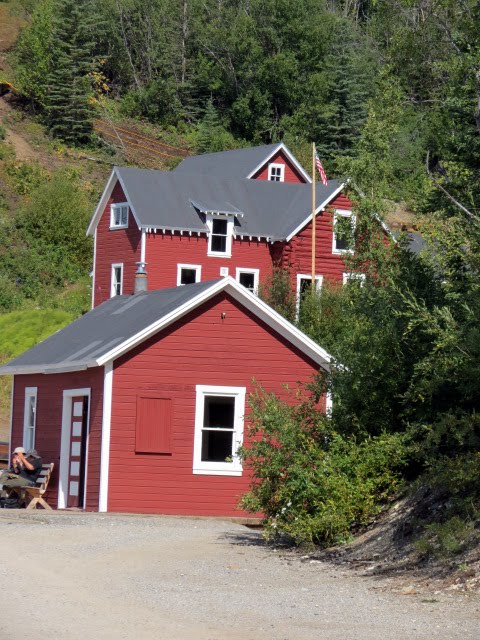
Not an original building, but it is a lodge and restaurant.
A long shot with lodge on the right.
"Overall, Kennecott was a community of men who came and went. Their length of stay ranged from three months and paying off their train fare to (as long as) several years. They lived two to a room and shared washing facilities with bunkhouse mates for $1.25 a day. There were several bunkhouses spread throughout the mill and mine sites. Kennecott hosted multinational crews including traditional Northern miners such as Norwegians, Swedes and Irish workes to Japanese cooks who provided meals and other camp services. Single women who worked in camp lived separately in an area called "No Man's Land" above the hospital in the staff house."
This is the West Bunkhouse. There was also an East Bunkhouse and other bunkhouses around the mine.
An older outside toilet and it did have a 'modern' seat! Bet that was cold in the winter!
Liz and I had lunch at the Lodge. She went to the ladies room and when she came back and I said my turn - she said take your camera! What a hoot this was. This was the wall to the left of the stool. It was for soaps.
This back wall was also for soaps.
I didn't get the overall one in front of the stool, but here they are individually. They are all about constipation and the many ways of relieving that ugly complexion or attitude!!!
Some of the soaps individually.
Went back out to the upper patio dining area and had this view, with a giggle.
The layout was too large for one photo so I broke up into 3 shots.
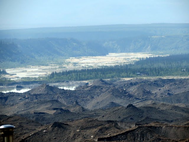
The tailings left from the mining. What to do with them? They have probably polluted the river for the last 100 years. The river is fed by the Glacier.
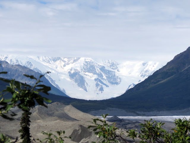
The glacier as it feed down into the tailings and valley.
There was a lot of rock to deal with also. Some was used to fill in the side of the mountain so they could build on it and 'expand' the area.
"You might think a community with a glacier at their back door would not need a refrigerator, but this innovative corporation always took advantage of latest technology and materials they had available, in this case ammonia." As you entered the building you saw the access to the railway that helped to move food supplies in and out of the building, the cooling motor, and the still hanging meat hooks.
The Refrigeration Plant
Meat cutting area.
Meat hanging locker.
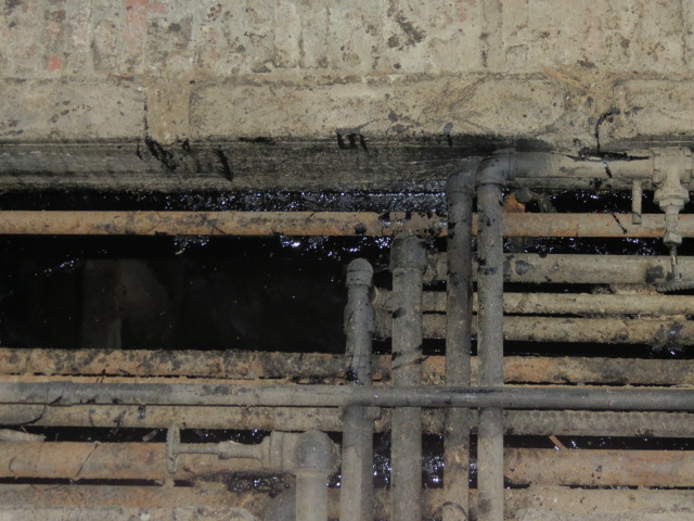
Cooling pipes.
Ooops someone came to visit recently or not recently!
"The U. S. Post Office and General Store connected the remot residence of Kennecott to the outside world. Families could purchase just about anything that could be found in the "lower 48". If the store did not hjave it, an order could be placed through popular catalogs."
Next door the store and post office, part of which was "open".
The large building toward the back is probably the most famous and most photographed building. It is the Concentration Mill and is stepped down the mountainside. That was done based on need as time passed, the ore quality changed and a need for better productivity and recovery (read more profit) was desired. Those are all my words, you get theirs later. The small building just before the bridge was the Assay office.
Information about the National Creek (the little creek behind the building) Flood of 2006. It nearly wiped this building out. It was under about 10 or 12 feet of water.
The Assay office in front and the General Management Office (GMO) above it on the hill.
The hospital on the left and the East Bunkhouse in back and the National Creek Bunkhouse in front on the right side of that little bitty creek, National Creek. Caused lots of problem when it flooded and it did several times. Today, 8/15/2012, you could walk across it with your hiking shoes on.
The GMO on the hill with the Concentration Mill behind it and in view out of every window.
There are I.
These offices were oppulent, even for those days. I'd say this was the GM's office. Closet behind the entry door.
Built in book case. You couldn't see the bookcase in the other room.
Another view out the window.
Looking out the window of the office that I'd think would be the GM's office. Ype that's the Concentrator up there.
The office entry area...reception area?
The very large safe in the back left corner of this room.
Downstairs safe.....well safe within a safe.
Shelving within the safe.
The stairs were well worn as you can see.
This was a second safe upstairs with even more room to hold either samples or papers.
Looking out one of the upstairs window.
Built in bookcase or sample case or both.
Outside the office is a trail leading up the side of the mountain to the Concentrator Mill and houses or as they call them 'cottages'. It also goes by a upper fall of the National Creek.
Caught Liz!!!!! That's a commode behind her!
The falls of National Creek.
That board on the left side is part of a ladder system that had been attached to a cable dropping down to the creek. I guess someone had to crawl down there for some maintenance issue from time to time.

Concentration Mill - The expense of shipping ore to Tacoma required the copper ore to be concentrated to maximize profitability. The cheapest and most economical concentration for most of the Kennecott's rich ore was gravity. The ore and waste rock arrived at the mill from the five remote mine sites by tramway at the rate of up to 1,200 tons of ore per day. From the tram, the ore went through a series of crushers and sorters, set up on a hill, using gravity and water to move the rock from one process to the next. Once the tailings were removed, the ore was loaded into burlap bags, stacked on open rail cars and shipped to the coast. Construction of the mill evolved over 20 years as new mining processes were developed. Over time, deteriorating ore quality demanded different processing techniques, continual equipment modifications, and additions to the mill structure. Resulting in the current unusual roof line and jumbled appearance of the red iconic building.
Top of the Concentration Mill. This is where it all started down hill.
This makes you stop, even if you weren't thinking of obeying the caution keep out tape!
Looking down and out from the top.
Berries are ripe - where are the bears? Never mind we caught up with him/her.
Our mantra when we saw ripe blueberries? Hey Bear!
Cottages and Silk Stocking Row. "Approximately 10% of Kennecott's population was lucky enough to live in single-family cottages with their families. Middle and upper management level employees paid about 1/4 of their income to have their families near them. The cottage positioning, available plumbing, room sizes, and exterior building colors all reflected one's level of status in the town."
Entitled "Living the Comfortable Life"
Ending statement. "Any place is comfortable if you make it that way." Shift Boss!!
Cottage kitchen - yes they had running water and they had hot water. I missed the living room photo.
We thought a pantry off the kitchen, but it could have been a small bedroom or dining room.
Thought this was a wash room. Perhaps back porch (because of the red paint) that was later enclosed.
A back bedroom. Had a door behind me going into the bathroom.
A front bedroom with the door going into the bathroom which had a tub, wash vanity and toilet.
Step out the back to this view.
Neighbor over on the back right side.
Neighbor on the back left side.
The front of the house - oh, yes the train ran about 8 feet in front of the house. That had to be fun!
The Power House is next and it explains the hot water these folks had available.
Looking down you see all the pipes running every which way.
Power House story. "Kennecott required power, and generating power in the wilderness, on a sizable scale, required imagination and effort. The power plant is characterized by four towering smoke stacks and was constructed in three stages betwee 1911 and 1924. The original structure burned in August 1924 and was quickly rebuilt by October 1924, following the same footprint. The plant used two diesel generators, one Westinghouse steam turbine and a Pelton waterwheel to provide power and steam heat to the entire town. Steam and electricity traveled to outlying building and homes through "utilidors", called underground wooden conduits. These were often built under wooden walkways, keeping them free of snow and ice in the winter."
Looking up at the Concentration Mill with the Transformer Shop and a Storage Shed in the foreground..
These buildings were, I think, part of the very large complex of 'leaching buildings'. They used ammonia and steam to get a very concentrated ore. As the quality declined they installed a flotation process (1923) to deal with the flour-sized pieces of low grade ore which accounted for 10-12% of their ore. If you want the entire process, post a comment and I'll get it to you.
Looking up from the bottom to the top of the Concentration Mill.
The National Park Service is continuing to work on the restoration of some of the buildings and the Concentration Mill is one of the building they are working on. That's a big job.
On to McCarthy.
Here is where you can find the mining and ore data.
http://tinyurl.com/2df642x
If you search under the Wiki for Kennecott, AK you can read some more information and follow the links you would like.